
Where to find a Nasdara map with loot and grid squares plus how to read DayZ coordinates and find a compass.
Nasdara Interactive Map: DayZ Badlands Map Tools
Quick answer: Bohemia has not published an interactive Nasdara map. The clickable ones are community projects: iZurvive carries the Nasdara terrain with a grid that matches the in-game tourist map, and map sites drawn from the game files cover the same 267 km². In game, navigate with the Tourist Map item plus a Compass or GPS Receiver.
- Official viewer: none published as of October 18, 2026, three days after the Badlands launch
- Best working map: iZurvive on web and app, with loot icons, shared markers and a coordinate search box
- In-game tools: Tourist Map (1x2 slots, 40 g), Compass (190 g) and GPS Receiver (350 g, needs a 9V battery)
- Grid: 1000 m lines zoomed out, 100 m lines zoomed in, matching the tourist map grid in the game
What Nasdara Map Tools Exist Right Now
Badlands launched on October 15, 2026, and Nasdara map data followed within days. Here is what is actually usable, and what each option lacks.
| Tool | What you get | What is missing |
|---|---|---|
| iZurvive Nasdara map | Topographic and satellite layers, lootmap icons, a box for typing in-game GPS coordinates, markers, circles and shared squad groups | Per-server loot profiles, because no Nasdara community servers are listed there yet |
| Map sites drawn from the game files | Terrain with a 1 km grid overlay, route measuring, your own pins | No link to your live position, so you still read coordinates off the game |
| Coordinate-search map tools | Search a location, building or item, jump to an X, Y pair, and share a URL that keeps your pins and routes | The richer loot filters on some of these sit behind a paid tier |
| Tourist Map item plus GPS Receiver | The terrain you are standing on, with your own position printed onto it | The map is loot, so nothing works until you find one |
iZurvive is the tool most players settle on. Its changelog lists the Nasdara map arriving for DayZ 1.30 and lootmap updates that added fuel stations; its grid matches the tourist maps in the game, at 1000 m zoomed out and 100 m zoomed in. It is not a Bohemia product, and its Nasdara page reports no community servers for the map yet, so expect vanilla loot data.
Official source: DayZ Badlands - Steam store page - "Explore the largest map for official DayZ – 267km² of vast, desert-themed wasteland that's located west of Chernarus and borders Takistan's western frontier."
How DayZ Coordinates Work on Nasdara
DayZ does not use latitude and longitude. It uses metres measured from a corner of the terrain, and the modder-facing convention is that X is the east-west axis, Z is the north-south axis, and Y is height.
| Map | Side length | Area | Source of the figure |
|---|---|---|---|
| Chernarus | 15,360 m | about 230 km² | 2048 terrain cells at 7.5 m each, confirmed by Bohemia's forum staff |
| Livonia | 12,800 m | about 168 km² | Same cell convention |
| Nasdara | roughly 16,380 m | 267 km², official | Maps drawn from the game files put it at 16.38 km per side |
That leaves Nasdara with a coordinate space running from 0 to about 16,380 on both horizontal axes. Reading a pair is the same procedure every time:
- Read the east-west number first, then the north-south number. A GPS Receiver prints both, plus altitude.
- Drop the last two digits of each to name the 100 m square you are standing in.
- Drop three digits to name the 1 km square, the scale most players use for a meeting point.
| Readout in metres | 100 m square | 1 km square |
|---|---|---|
| X 11460, north-south 7396 | 114 / 073 | 11 / 07 |
| X 8240, north-south 11210 | 082 / 112 | 08 / 11 |
| X 4800, north-south 4800 | 048 / 048 | 04 / 04 |
Writing the north-south number first is the most common mapping mistake. On a 16 km terrain a swapped pair at X 11460 and north-south 7396 puts you about 5.7 km from where you actually stand, which on Nasdara is a different valley and usually a different loot route.
Official source: DayZ Badlands | Dev Blog (Week 63) - "Nasdara Province is our largest terrain yet, spanning over 267km2."
The grid exists so a coordinate taken from the game lands on the same square on the web map.
Reading Your Position In Game
Three lootable items do the work, and the Tourist Map is the one that has to come first.
| Item | Slots and weight | Spawns | What it does |
|---|---|---|---|
| Tourist Map | 1x2, 40 g | Civilian buildings, uncommon to rare | Topography, marked trails and landmarks. Hold it in your hands and left click to open, ESC to put away |
| Compass | 1x2, 190 g, 70 durability | Hunting, camping and forester loot, common | Shows the direction you face. Hold and left click to open, or keep it on a backpack strap slot or hotbar so it keeps working |
| GPS Receiver | 1x2, 350 g, 50 durability | Hunting loot, rare | Prints world position and altitude. Add a working 9V battery and use Switch On; repair with an Electronic Repair Kit |
The map screen prints an extra readout into its bottom-left corner when you carry a GPS Receiver or a Compass, which is what turns the paper map into a navigation tool:
- Loot a Tourist Map from civilian buildings. It is uncommon to rare, so treat it as a find rather than starter gear.
- Add a Compass, which is common, or a GPS Receiver, which is rare and needs a 9V battery.
- Open the map from your hands with a left click and read the coordinate pair in the corner.
- Type that pair into a community map's coordinate box, which accepts the exact numbers the receiver shows, and drop a marker there.
- Name the marker for what it is, not for where it is. "Well, north edge" survives a week; "114 073" means nothing once you have crossed the map.
Hiking trail stands are common loot and sometimes hold a large trail map that always shows your current location. Woods and marked trail routes are worth a detour for that alone, especially before you have a Tourist Map.
Finding Your Position Without a GPS Receiver
Nasdara is fully inland, so the Chernarus habit of walking to the coast does not apply. You read the ground instead.
- Road signs name the settlement and the distance in both English and Farsi. Reading one and matching the name to a pin on a map is the fastest fix when you are lost.
- Power lines cross the terrain and usually end at a settlement or substation. Slow, but reliable on a long haul.
- Hiking trails are marked with wooden posts and signposts, and the trail markers also appear on the tourist map.
- The sky is the fallback. The sun rises roughly in the east and sets in the west, and Polaris sits roughly north on a clear night.
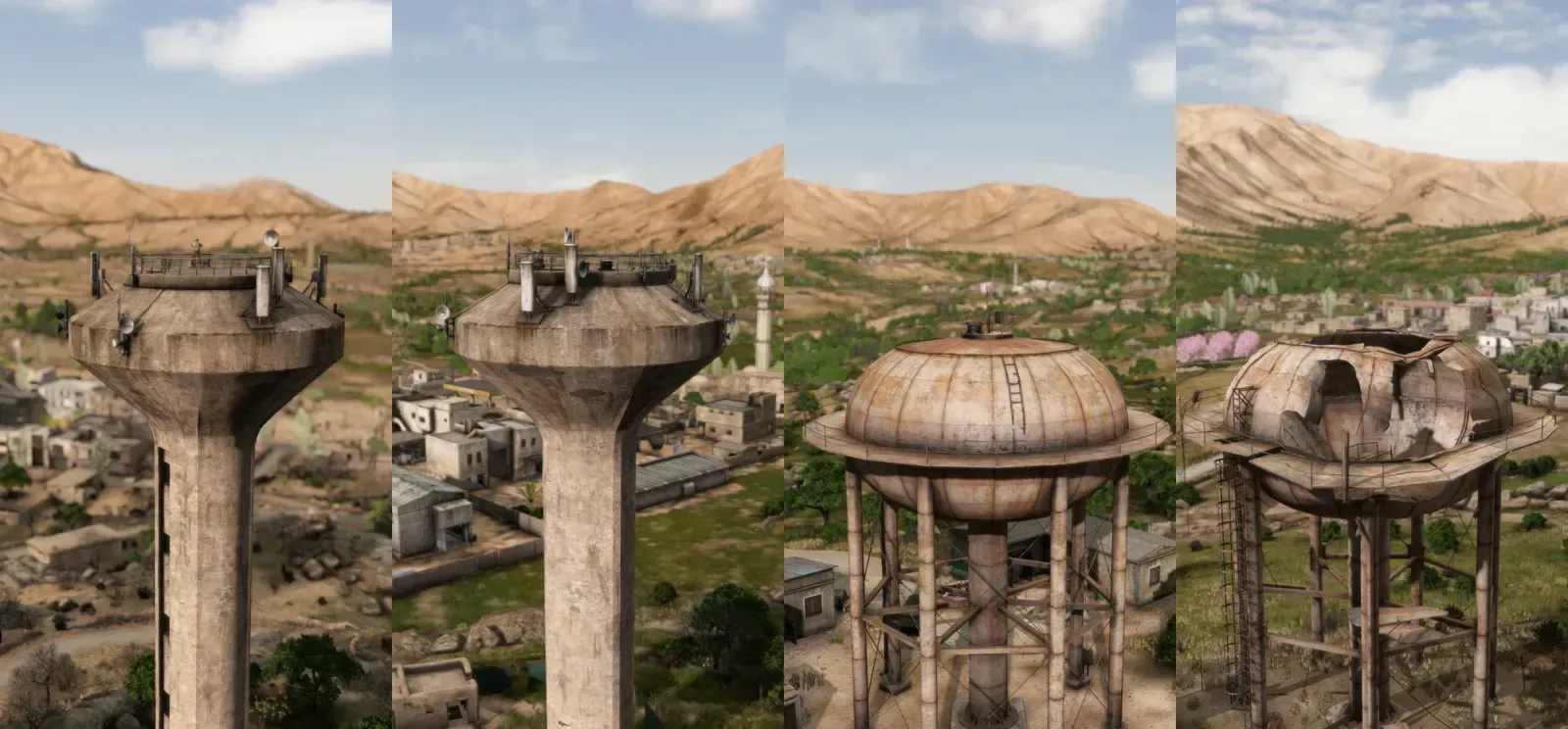
Ruins like these are landmarks you can match to a map, which matters more on Nasdara because there is no coastline to navigate by.
A Rangefinder measures the distance to whatever you point it at, so a two-landmark fix beats a guess about which ridge you are on, and binoculars do the same at longer range. The axis convention is documented for modders on DZconfig's map tools page.
Turning a Coordinate Into a Route
A coordinate on its own does nothing. A coordinate plus a marker plus a route does:
- Get a number from the map screen readout, or search a landmark's name on a community map.
- Drop a marker at that coordinate and give it a name you will still understand tomorrow.
- Build the route in the tool. Distance tools show metres between two points and some estimate walking and sprinting times, which is what you need when water is on the clock.
- Share the route instead of a screenshot. Marker groups let a squad see the same pins, and map URLs preserve pins and paths, so a friend opening the link sees what you see.
- Re-check pins after a server change. On modded servers, spawn points, traders and safe zones come from the server's own coordinate files, so nothing you memorised on one server transfers to the next.
The paper map shows terrain and, with a compass or receiver, your position. Markers and a compass HUD arrive through mods or server settings, which is why two servers running the same map can behave differently. Check what the server runs before building a route around markers.
Nasdara-Specific Navigation Traps
Heat and water decide the route, not the distance. Direct sunlight affects character stats on Nasdara and the map offers very few water sources, so plan routes around wells and shade. The water and wells guide covers what to look for; the heat and heatstroke guide covers the cost of getting it wrong.
Sandstorms cut visibility. They shipped with Badlands, but Bohemia has published no damage or duration figures, so no map tool knows how long one lasts. Treat a distant pin as a rough bearing.
Every pin traces back to the game files or to a player. The dev blogs named regions and landmarks, never grid references. If two readouts disagree, trust your own.
Loot routes are the usual reason to care about any of this. The cities and bazaars guide covers urban routes; the military bases and bunkers guide covers the tier above them.
FAQ
Where can I find an interactive Nasdara map?
iZurvive has the Nasdara terrain with loot icons and a coordinate box, and there are map sites drawn from the game files. Bohemia has not published one of its own.
How do I read DayZ coordinates on the Nasdara map?
East-west number first, then north-south, both in metres from the map corner. Drop the last two digits of each for the 100 m square, so X 11460 with north-south 7396 becomes 114 / 073.
Is there an official DayZ Badlands map with grid squares?
Not from Bohemia. The community grid matches the tourist map in the game at 1000 m zoomed out and 100 m zoomed in, which is why a coordinate from the game lines up with it.
Why can't I see my position on the map?
The map has to be in your hands and open, and the corner readout only appears if you carry a GPS Receiver or a Compass. Without either, you match terrain by eye.
Does the Nasdara map show where loot spawns?
Community maps do, on vanilla loot tables. The in-game Tourist Map shows landmarks such as wells, trail signs and settlements, not item spawn points.
Related Guides
- Nasdara Map Overview - the regions and climate behind every pin you place.
- DayZ Badlands Map Size and Regions - why the coordinate space is 16 km across, and which places have official names.
- Nasdara vs Chernarus - what changes when the map has no coast to navigate by.
- DayZ Badlands Beginner Starter Guide - where the map and compass fit into your first hours.
More DayZ Badlands Guides
Direct sunlight drains your stats in Nasdara. Clothing, shade and hydration rules to avoid heatstroke in DayZ Badlands.
DayZ Badlands zombies are region-specific infected with a sun-bleached look and a reworked three-angle attack. Confirmed before launch on October 15.
DayZ Badlands lore: Nasdara is not an Arma 2 Takistan remake but a new 267 km² province with a confirmed history, factions and bilingual signs.
Oil drills and refinery infrastructure are confirmed Nasdara landmarks, but no loot table is published yet. Every confirmed mention, plus the PvP case.
Run Nasdara on your own DayZ Badlands server: 1.30 ships October 15, 2026 and the Nasdara mission folder name is still unpublished.
A water truck turns a squad into a moving well. Where players have found one on Nasdara and how to run it.
Nasdara has very little standing water and most wells died in the war. Where DayZ Badlands water comes from and how broken wells get repaired.
Yes you can. A 3 dial lock holds 1000 codes and a 4 dial lock 10000. Crack times plus the wall destroying route instead.